Original Article
, Volume: 5( 3)Bearded Profile with Avian Headdress within the Southeast-Facing Slope of an Impact Craterin the Utopia Planitia Region of Mars
- *Correspondence:
- Haas GJ , The Cydonia Institute, PO Box 102, Purcellville, Virginia 20132, USA, Tel: +1 215-898-5000; E-mail: thecydoniainstitute@hotmail.com
Received: September 09, 2016; Accepted: October 27, 2016; Published: November 15, 2016
Citation: Haas GJ, Saunders WR, Miller JS, et al. Bearded Profile with Avian Headdress within the Southeast-Facing Slope of an Impact Craterin the Utopia Planitia Region of Mars. J Space Explor. 2016;5(3):103.
Abstract
This is an analysis of a facial formation set within an impact crater located in the Utopia Planitia region of Mars. The formation is presented in four NASA images provided by the Mars Odyssey (MO) and Mars reconnaissance orbiter (MRO) spacecraft. The images reveal a sculpted rendering of bearded portrait of a human face with an avian headdress. The facial features include a recessed eye socket, nose, mouth, mustache and beard. The headdress consists of a large wing with an attached avian head, beak and neck. When taken together these facial components induce the visual impression of left facing portrait of a beaded male wearing an avian-shaped headdress. The claim of intelligent design is offered and a geologist and geoscientist examine natural mechanisms that could contribute to the formation of these features. A terrestrial comparison of aesthetic and iconographic motifs is investigated. Further study and a request for additional images of these facial components are also encouraged.
Keywords
Mars; Utopia planiti; Geoglyph; Viking lord; Avian; Artifacts; Mars odyssey; Mars reconnaissance orbiter
Introduction
History
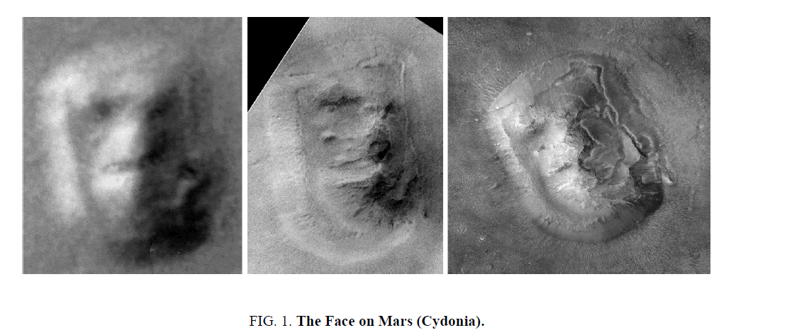
The Viking I and Viking II orbiters obtained thousands of images of the Martian surface between 1976 and 1980 that covered the entire planet [1]. One anomalous mesa in the Cydonia region caught the attention of NASA scientists that had an uncanny resemblance to a human head, known as the famous face on Mars, a large, rectangular mesa approximately 2.5 km long appeared to have facial features, showing an eye, nose, and mouth (Figure.1. left). Beyond NASA’s initial claim that the facial features were natural and the results of “a trick of light and shadow,” some independent researchers suspected the formation to be artificial. Richard Hoagland maintained that the face was not human, but was a bifurcated mask. He saw a humanoid visage on the western side and a feline visage on the eastern side [2] mush like the human-feline masks produced throughout Mesoamerica [3]. With the release of higher resolution pictures of the formation, provided by the NASA’s Mars global surveyor (MGS) in 1998 (Figure.1.center) and 2001 (Figure.1.right), a former orbital imaging specialist for the US Naval Observatory, Dr. Tom Van Flandern [4] and an electrical engineer with an expertise in digital imaging Dr. Mark Carlotto [5] concluded that facial features may indeed be artificial.
Left: Viking - 70A13 (1976). Image courtesy NASA/JPL/Cydonia Institute.
Center: Mars Global Surveyor - SP 220003 (1998). Image courtesy NASA/JPL/Cydonia Institute.
Right: Mars Global Surveyor - E03-00824 (2001). Image courtesy NASA/JPL/Cydonia Institute
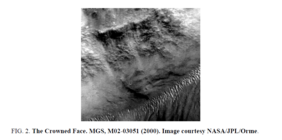
In the summer of 2000 independent researcher Greg Orme discovered a band of facial features within the Libya Montes region of Mars in MGS narrow-angle image M02-03051 (Figure. 2) [6]. The formation, known as the crowned face, revealed a composite set of portraits showing three human and humanoid faces with individual eyes, nose, mouth, chin, and crown features. The formation was confirmed in 2010 with two high resolution MRO (MRO) high resolution imaging science experiment (HIRISE) images [7].
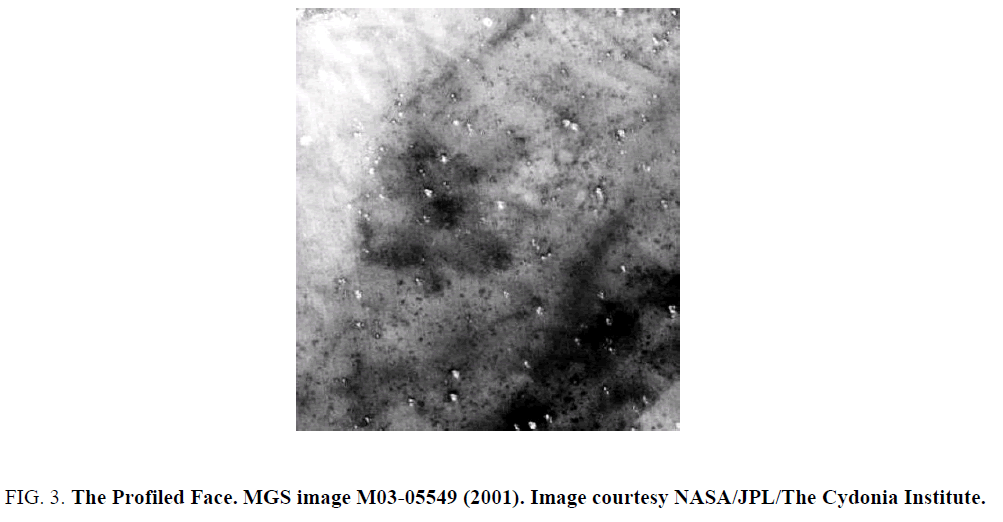
A third facial formation was observed in MGS narrow-angle image M03-05549 by a member of the society for planetary SETI research (SPSR) JP Levasseur in 2001 (Figure. 3). Located within the Syria Planum region of Mars the formation features the profiled portrait of a human head wearing a cylindrical headdress [8]. The features include an eye, nose, mouth, chin, hair and headdress. Additional images provided by the MGS and MRO high resolution imaging science experiment (HIRISE) CTX camera confirmed the formations facial features and headdress [9].
Figure 3: The Profiled Face. MGS image M03-05549 (2001). Image courtesy NASA/JPL/The Cydonia Institute.
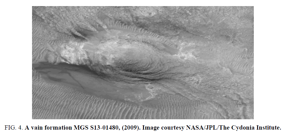
An avian-shaped formation was discovered by Anthropologist Wilmer Faust in 2002 within the Argyre Basin region of Mars in Mars global surveyor image M1402185 [10]. The avian-shaped formation was examined by three veterinarians and found to have over 17 points of anatomical correctness [11] which included a head, body, and wing. Additional images provided by the MGS (Figure. 4) and MRO, high resolution imaging science experiment (HIRISE) CTX camera were obtained and confirmed the formation’s extensive set of avian features.
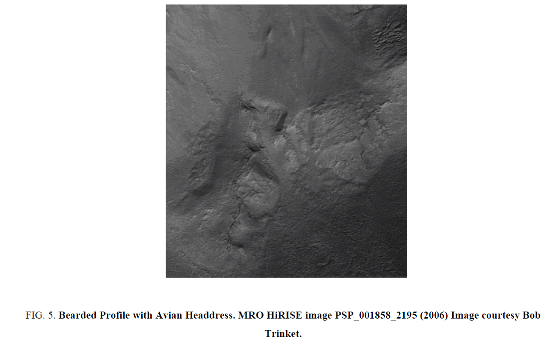
In the winter of 2007 independent planetary researcher Bob Trinket observed an artistically fashioned face along the southeast-facing slope of a large impact crater in MRO HIRISE image PSP_001858_2195 [12] that conforms to the shape of a portrait of a beard man with an avian headdress. Intrigued by the facial contours of the formation, Trinket posted his findings for further analysis on the meta research discussion board on November 10, 2007 [13] (Figure. 5). After viewing the formation, the lead author of this paper agreed that the formation did appear human-like and remarked that the formation portrayed a strikingly masculine portrait resembling a Norseman Viking with an avian headdress and titled the formation the Viking Lord [13].
Figure 5: Bearded Profile with Avian Headdress. MRO HiRISE image PSP_001858_2195 (2006) Image courtesy Bob Trinket.
Fellow meta research member Neil De Rosa commented that “In this (north) oriented face … we can see an apparently detailed headdress, a small face emblem above the forehead, good profile outline, and good bas-relief shading in the face and headdress” [14].
The Bearded Profile with Avian Headdress
Mo and MRO images
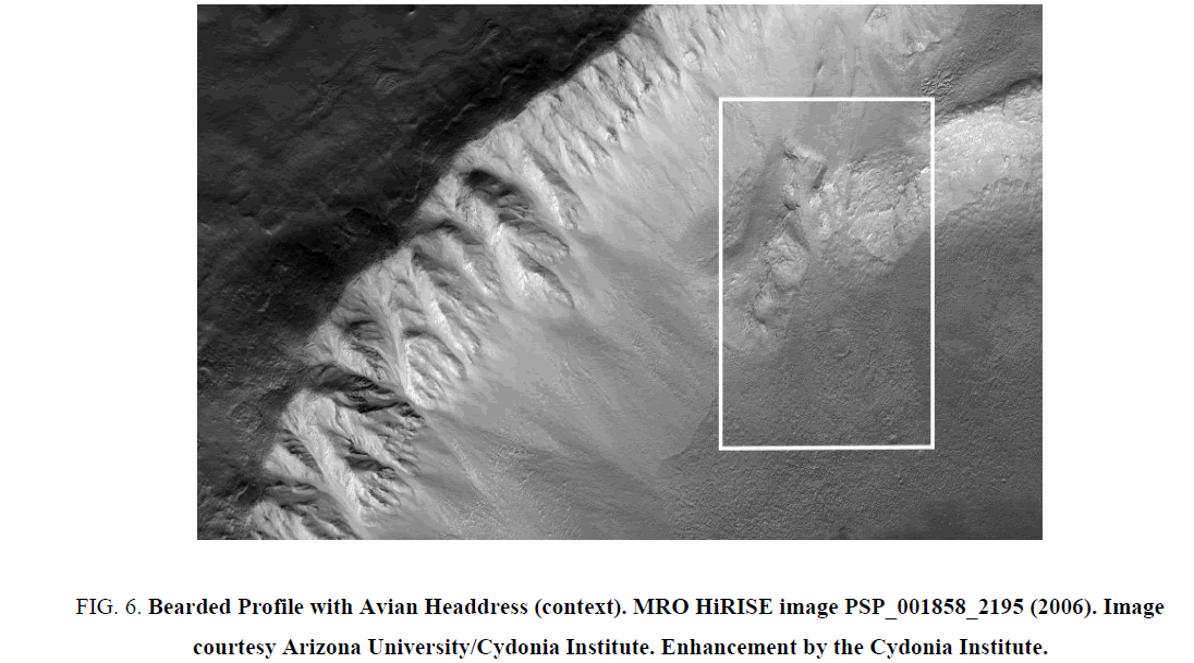
The original image for this study was obtained via the MRO HiRISE section of the Arizona Universities Mars Image Explorer web site. The MRO image PSP_001858_2195 was acquired on December 19, 2006 [15]. The area examined is in the Utopia Planitia region of Mars located between 392° south latitude and 116.4° east longitude. The formation is located towards the bottom of the swath along the bottom ridge line of the inner slop of a crater. The area of interest is highlighted within the boxed section of the image in Figure. 6. The formation is approximately 215 m long from the chin to the top of the avian headdress.
Figure 6: Bearded Profile with Avian Headdress (context). MRO HiRISE image PSP_001858_2195 (2006). Image courtesy Arizona University/Cydonia Institute. Enhancement by the Cydonia Institute.
Mo image
In April 2001 NASA launched the Mars Odyssey spacecraft from Cape Canaveral Air Force Station in Florida. The spacecraft was equipped with an on-board camera called the thermal emission imaging system visible camera (THEMIS-VIS) that was designed to provide systematic global coverage of Mars in both the visible and IR bands. The THEMIS infrared camera on board the Mars Odyssey spacecraft records temperature changes on the surface associated with volcanic heating and near-surface water or ice. THEMIS infrared images taken during the day will look much like a shaded relief map, with areas facing the sun being bright (hot) and shaded areas being dark (cold). In a THEMIS, inferred image taken at night the instrument can detect temperature differences due to the various materials present within the surface [16]. The primary focus of the THEMIS investigation was to collect IR data and black-and-white images. Color images would be selective and controlled by the limitations in data rates and by NASA’s desire to focus on the IR data and obtaining global coverage in an effort to study what they call the planet's “remarkable geomorphology” [17].
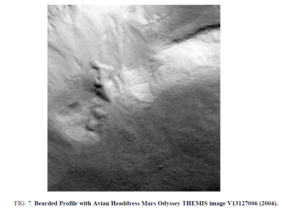
In 2004 the Mars Odyssey THEMIS camera acquired image V13127006 [18] (Figure. 7). The THEMIS image shows a distinct formation in the shape of a bearded profile of a human head with an avian headdress. The facial features appear soft and include a thick brow and dark recessed eye feature. There is evidence of a nose, mustache, and bearded chin. The portrait wears and winged headdress with a prominent avian head feature.
Three MRO images
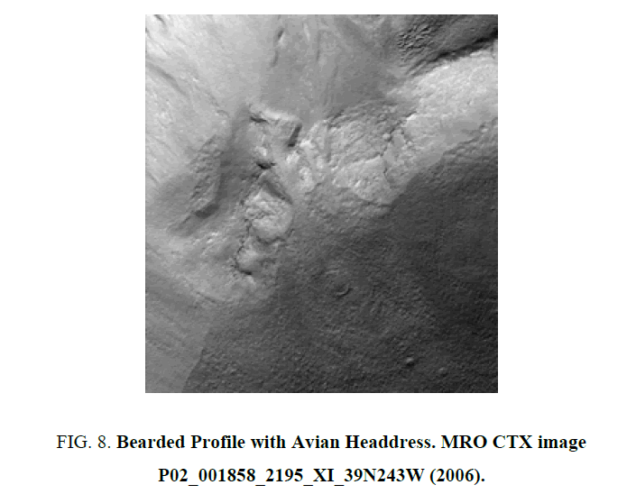
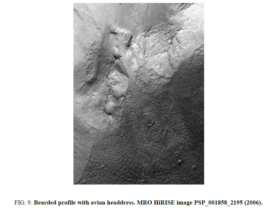
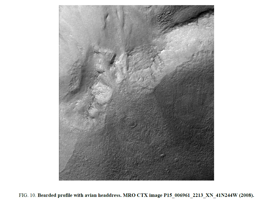
During 2005 the MRO spacecraft launched from Cape Canaveral in route to Mars with the high-resolution imaging science experiment camera, referred to as HiRISE and a context camera known as CTX [19]. The MRO acquired three images of the formation. The first image released P02_001858_2195_XI_39N243W (Figure. 8) was acquired with the CTX camera in December 2006 [20]. A second image PSP_001858_2195(Figure. 9) was acquired by the HiRISE camera in December 2006 [21] and the third image P15_006961_2213_XN_41N244W (Figure. 10) was also acquired by the CTX camera in January 2008 [22].
In order to adjust the viewing perspective all three images have been rotated to the west by 90° and cropped at the top and bottom of the strip. Due to the direct sun exposure to the crater wall, during the morning and late evening hours, each of the images were enhanced with minor contrast adjustments to the original presentation. The two CTX images are geographically incorrect having been released without being orthographically rectified. Both CTX images are slightly stretched and distorted by a skewed emission or slant angle and do not provide an accurate view of the formation. Utilizing the MRO HiRISE image PSP_001858_2195 as a template, the two CTX images were compressed vertically by 20% and their distortions were corrected. This new set of images support the facial features observed in the Mars Odyssey THEMIS image V13127006. Notice the thick brow and dark recessed eye feature. The newer images show additional evidence of a nose, mustache, and bearded chin. The avian feature observed within the winged headdress is also more prominent.
MO and MRO ancillary data-sun and camera angles
There are considerable differences in the time frame, telemetry, sun angle, resolution and other factors of the four images; a comparison chart is presented as Table 1. The basic facial features persist throughout the four images, and some features that were obscured in the first MO image are now visible in the second, third and fourth MRO images. The first image of the formation MOV13127006 was taken in 2004 during the Martian summer in the late morning hours (6:19AM) with the Sun about 19° above the horizon. The image was taken from an emission or camera angle of 0.28° off nadir with a resolution of 18.7 m per pixel. A second image MRO CTX P02_001858_2195_XI_39N243W was acquired in 2006 during the Martian summer in the morning (5:38 AM) with the Sun about 37° above the horizon. The image was taken from an emission or camera angle of 6.11 off nadir with a resolution of 5.95 m per pixel. The third image acquired by the MRO HiRISE.
| Image Number | V13127006 | P02_001858_2195_XI_39N243W | PSP_001858_2195 | P15_006961_2213_XN_41N244W |
|---|---|---|---|---|
| Image Start time SCET | 2004-11-29 T 06:19 | 2006-12-19 T 05:38 |
2006-12-19 T 03:25 |
2008-01-20 T 21:01 |
| Resolutionper pixel | 18.77 m | 5.95 m | 30.1 cm | 5.96 m |
| Emission Angle | 0.28° | 6.11° | 6.2° | 3.91° |
| Incidence Angle | 71.67° | 53.32° | NA | 46.03° |
| Phase Angle | NA | 59.35° | 59.3° | 49.56° |
| Center Longitude | 116.43° E | 116.41° E | 116.40° E | 116° E |
| Center Latitude | 38.76°N | 39.54° N | 39.17° N | 41.31° N |
| Spacecraft Altitude | NA | 294.64 km | NA | 297.28 km |
| North Azimuth | 266.4° | 277° | 270° | 277° |
| Sun Azimuth | NA | 169.97° | 163.7° | 152.25° |
| Solar Longitude | 121.7° Summer |
152.72° Summer |
152.7° Summer |
20.43° Spring |
| Local True Solar Time | 6:19 AM | 5:38AM | 3:25 PM | 9:01 PM |
| Release date | 11/29/2004 | 12/19/2006 | 12/19/2006 | 1/20/2008 |
Table 1: Considerable differences in the time frame, telemetry, sun angle, resolution and other factors of the four images: A comparison chart is presented as.
Spacecraft, PSP_001858_2195 was taken during the 2006 Martian summer in the mid-afternoon hours (3:25 PM) with the Sun about 37° above the horizon. The image was taken from an emission or camera angle of 3.91° off nadir with a resolution of 30.1 cm per pixel. The forth image of the formation P15_006961_2213_XN_41N244W was obtained in 2008 during the Martian spring in the early evening (9:01 PM) with the Sun about 44° above the horizon. The image was taken from an emission or camera angle of 3.91° off nadir with a resolution of 5.96 m per pixel.
The geological context and measurements of the bearded profile with avian headdress
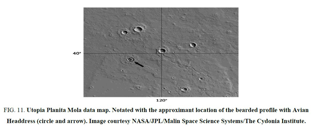
Utopia Planitia is located within the Casius quadrangle of Mars at 46.7°N 117.5°E (Figure. 11) [23]. It is home to the largest impact basin on Mars with an estimated diameter of 3300 km [24]. The area harbors the largest and most varied collection of periglacial landforms, including polygons, scalloped depressions, and pingo-like features [25]. It was also the landing site of Viking 2 lander, which touched down on the surface of Mars on September 3, 1976. The region was named by the Italian astronomer Giovanni Schiaparelli after an imaginary “perfect society” authored by Thomas More. The word utopia finds its root in the Greek word meaning “nowhere” [26]. The region is littered with rampart craters and has a patterned, "scalloped topography" that is thought to have formed by the degradation of an ice-rich permafrost [27].
Figure 11: Utopia Planita Mola data map. Notated with the approximant location of the bearded profile with Avian Headdress (circle and arrow). Image courtesy NASA/JPL/Malin Space Science Systems/The Cydonia Institute.
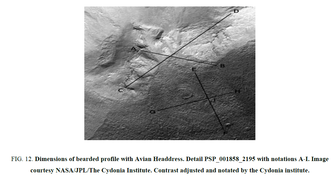
Paint Shop Pro 8 was the software used to pinpoint the pixel locations of the individual structural features of the bearded profile with Avian Headdress and its structural parameters are marked at A through S. Utilizing the MRO HiRISE image PSP_001858_2195 that was not rectified or corrected for slant a set of contour points were selected and the individual features were measured (Figure. 12). The structural perimeters of the Bearded Portrait with Avian Headdress expand from point A to point B, measuring 46.73 m wide and extend from point C to point D, measuring 215.6 m in length (Figure. 12) Within the face, the orbital cavity and nasal bridge are approximately 15 m in length. The neck and flap section extends from the rim of the helmet flap at point E to point F, measuring 106.98 m in length and from point G to point H it measures 46.73 m in width (Figure. 12). From the edge of the neck line at point G to the curvature of the back side of the neck at point I measures 53.9 m. The number three-shape formation located within the neck area of the formation measures 21.75 m in length and 15 m in width (Figure. 12).
Figure 12: Dimensions of bearded profile with Avian Headdress. Detail PSP_001858_2195 with notations A-I. Image courtesy NASA/JPL/The Cydonia Institute. Contrast adjusted and notated by the Cydonia institute.
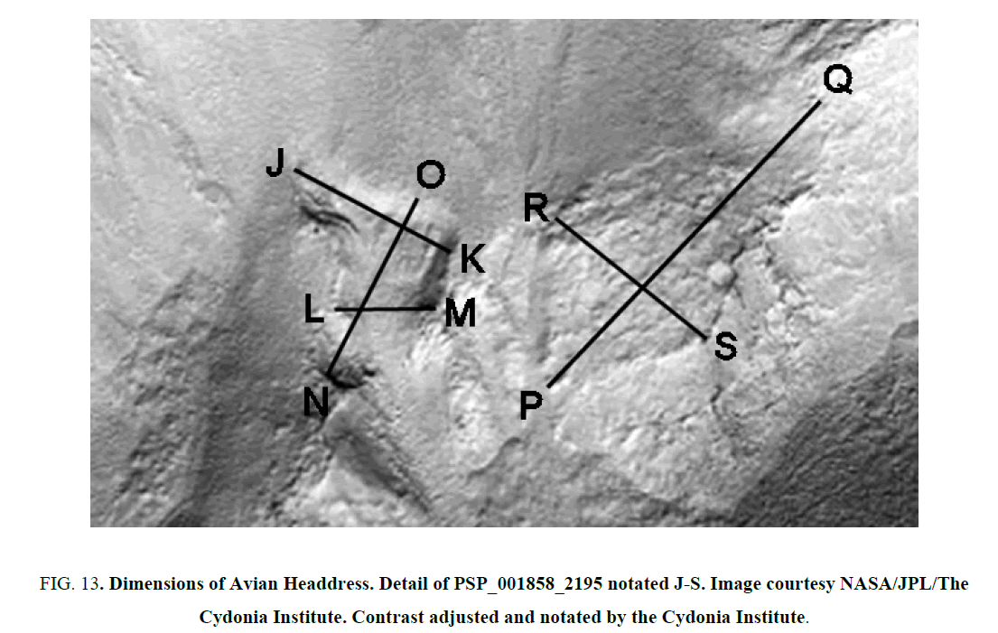
The structural parameters of the avian section of the formation begin along the neck line, at point N and extend to the top of the head, at point O, measuring 42.5 m (Figure. 13). The head area between the beak, point J and the back of the skull, point Kmeasures 33.75 m. The beak feature, within the head area is approximately 10 m in length. The width of the neck area measures 25.75 m from point L to point M. The waddle feature, below the neck, is approximately 15 m in length. The wing section extends 106.98 me in length from point P to point Q and is 50.26 m wide from point R to point S (Figure. 13). The most interesting result of these measurements is that many of the areas such as the orbital cavity, nasal bridge and waddle are all approximately the same size, measuring 15 m in length. The area between points A and B are equal to the area between points G and H, in Figure. 9. measuring 46.73 m. The area between points G and I measure 53.49 m, which is half the length of the area extending between points E and F that measure 106.98 m in length (Figure. 13). A similar set of common measurements is observed between points E and Fin (Figure. 9). that are equal to the area between the base of the headdress at point P and the tip of the wing form at point Q, in (Figure. 10). both measuring 106.98 m.
Figure 13: Dimensions of Avian Headdress. Detail of PSP_001858_2195 notated J-S. Image courtesy NASA/JPL/The Cydonia Institute. Contrast adjusted and notated by the Cydonia Institute.
Topography and morphology of the bearded profile with avian headdress
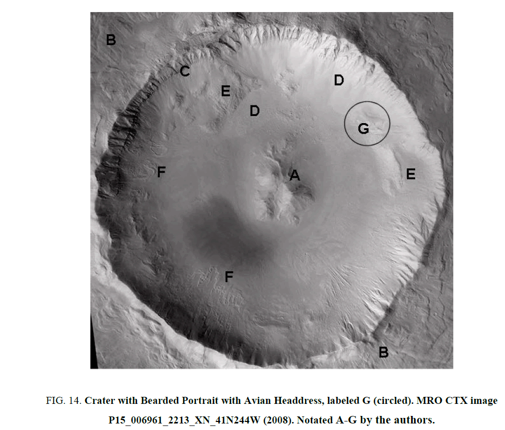
The image in question lies in the North-East Quadrant of an impact crater roughly 1600 m in diameter. The crater exhibits properties of a complex crater with its central peaks (Labeled A in Figure. 14) as well as of a ray system of ejecta (Labeled Bin Figure. 14). The crater’s size and location puts it at a younger age between late Hesperian and early Amazonian epochs [28]. The crater also contains several features indicative of both water and ice with evidence of glacial and periglacial ice activity [29]. This lens support that the central peak formations (Labeled A in Figure. 14) may be the result of exhumation of massive-ice wedges surrounded by a pit depression.
Figure 14: Crater with Bearded Portrait with Avian Headdress, labeled G (circled). MRO CTX image P15_006961_2213_XN_41N244W (2008). Notated A-G by the authors.
The rim of the crater shows gullies and sharp crevasses around the circumference of the crater wall (Labeled C in Figure. 14) some of which may be due to fluvial channeling. The gullies appear in blocky layers across the top of the crater rim that runs down the inner wall ending in triangular delta fans. The crater basin is covered with sediments and debris that may have been covered with a shallow pooling of water with many transgress/egress events, over the eons of time. Thus, cratering gullies formed as the waters were pushed away generating abundant fluvioglacial activity. The inside crater slope is layered by talus and Aeolian deposition (Labeled D in Figure. 14) while also occupied by a number of ridges exposed above depositional materials (exampled by E in Figure.14). There are lobate ridges on the west and south slopes of the crater reminiscent of glacial moraines (Labeled F in Figure. 14). These features can be created by the plowing effect of ice during down-slope movement. The exposed ridges (Labeled G in Figure. 14) appear as a scared depression showing a basin disturbance that conforms to the profiled image of this discussion.
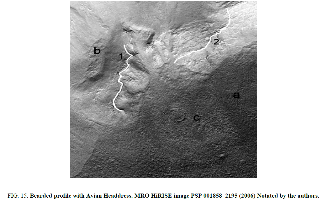
The contours of the facial formation are composed by two non-linear ridges, one of which forms the profile (Labeled 1 in Figure. 15), while the other forms the main construct of the headdress (Labeled 2 in Figure. 15). A dense rubble field is apparent below the inner slope of ridge 1, that rest in front of the profile, labeled B. The varying surface textures and lighting contrasts give this feature a very complex and heterogeneous appearance. Geomorphological influences such as glacial movement could be attributed to the striations seen to the right of the profile (labeled a in Figure. 15) however its isolation and limited extent is unusual. It is also possible they are ray system remnants. The sand paper-like texture observed in the lightly toned area below the profile (labeled C, in Figure. 15) may be the result previous glacial events of moving rock mixed ice.
Figure 15: Bearded profile with Avian Headdress. MRO HiRISE image PSP 001858_2195 (2006) Notated by the authors.
The structural construct of the bearded profile and avian headdress show extensive weathering around its boundaries and within its central crests. These features are consistent with the effects of wind, sand and water erosion observed in both natural and artificial formations. The diversity of the formation suggests multiple climate cycles with conflicting deposition events. Although the geological complexity of the headdress and facial features may be the result of a unique set of naturally occurring process, when examined individually the chances appear relatively low. A curiosity is that there are multiple surface textures within a crater area of roughly 300 m sq. It is, however undetermined as to either how such a diverse set of mechanisms would be isolated to such small areas. It is also unclear as to what other mechanisms would be required to form or rework the rest of the terrain to conform to the contours of the facial features of the bearded profile and avian headdress, again, in such a small area.
Aesthetic analysis of the bearded profile with avian headdress
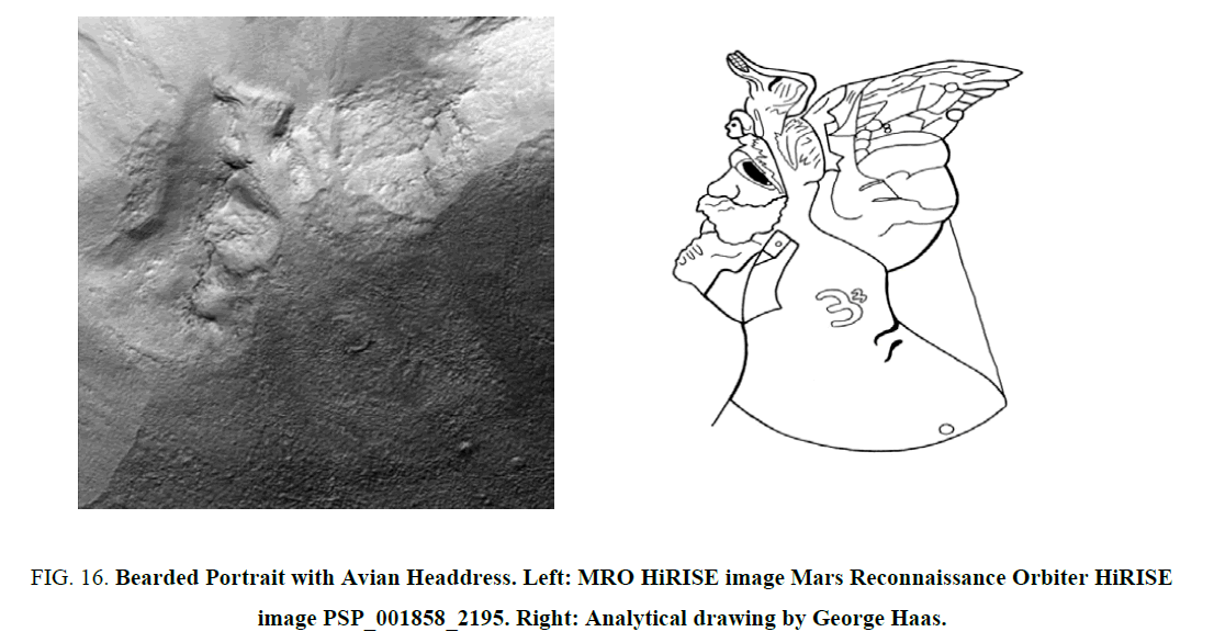
The facial portrait is presented as a left facing profile with a partially damaged nose and billowing mustache (Figure. 16). The mature face has a deep-set orbital cavity, a prominent brow, and a rugged nasal bridge. There is evidence of a lower lip between a short beard and a mustache that covers its full cheeks. The portrait displays a tight-fitting helmet with a chin strap. The helmet includes a nesting avian creature with cross bands that support an extended wing feature. The helmet is supported by a broad neck line that curves down from the base of the skull cap to the figures shoulder. Within the neck area is an embossed insignia that follows the shape of a number three. There is also a back-flap feature that extends down from the back of the helmet to the shoulder.
Figure 16: Bearded Portrait with Avian Headdress. Left: MRO HiRISE image Mars Reconnaissance Orbiter HiRISE image PSP_001858_2195. Right: Analytical drawing by George Haas.
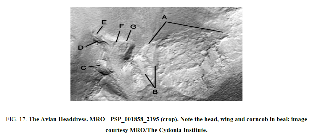
Looking at the avian creature within the headdress (Figure. 17), its nesting body consists of a large wing formation (Labeled A in Figure. 17) that may incorporate a set of collected feathers mounted by decorative straps, securing them to its back (Labeled B in Figure. 17). The profiled presentation of the avian head (Labeled G in Figure. 17) is triangular in shape with a flat skull cap with a closed eye (Labeled F in Figure. 17). The head is gestures upward with a thick neck and fleshy wattle (Labeled C in Figure. 17). It also has a parted beak (Labeled D in Figure. 17) that appears to be holding a small corncob (Labeled E in Figure. 17).
Figure 17: The Avian Headdress. MRO - PSP_001858_2195 (crop). Note the head, wing and corncob in beak image courtesy MRO/The Cydonia Institute.
Cultural Reference
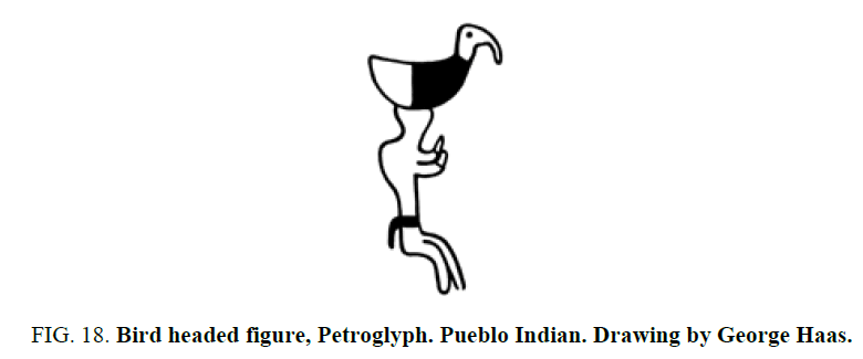
The avian headdress motif can be found throughout the artwork of Native Americans cultures all across North America. An early example is found in the rock art produced in the area in and around the Colorado Plateau, which features a petroglyph of a human figure wearing a large bird headdress [30] (Figure. 18).
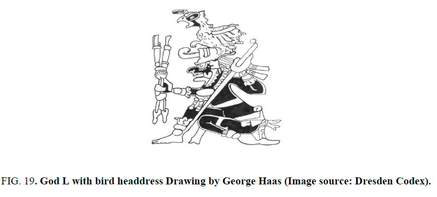
On the last page of the Dresden Codex there is an image of the Maya god referred to as God L, the god of the underworld realm known as Xibalba. He is most often depicted as a frail and aged god with wrinkled features. He has a toothless mouth, a large nose and at times is known to smoke vary large cigars. His most noticeable attribute is his large headdress that consists of an actual bird called Oxlahan Chan [31] (Figure. 19). Although the exact species of the bird is unclear, it is often identified as a falcon, but can also be depicted as an owl [32]. The bird that sits upon the head of God L in the Dresden Codex has a corncob attached to his beak that bears a resemblance to the bird headdress seen on Mars at Utopia Planitia.
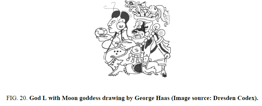
When the Sun rises, the Maya believed that the moon is led below the horizon into the underworld of Xibalba. Once there, the moon becomes the consort of God L and as a result she often finds herself engaged in provocative situations. In the Dresden Codex, the couple is depicted in an amorous pose in which the Moon goddess sits on the lap of God L as he gently touches her exposed breast (Figure. 20). In this scene, the couple displays their agricultural connection to maize. Notice the Moon goddess holds out a maize tortilla, represented here as the T506 glyph, while the bird within God L’s headdress has a kernel of corn in its beak and a flowing tail made of maize foliation [33].
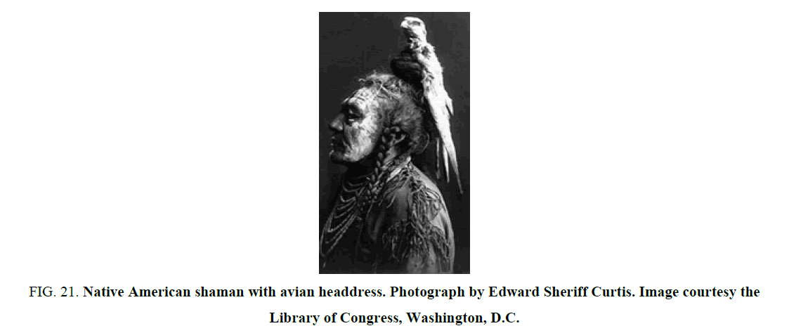
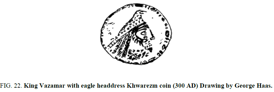
The use of birds by the indigenous peoples of North America as a part of a headdress continued well into the 20th Century. A portrait of a Native American shaman was recorded by the photographer Edward Sheriff Curtis in which an entire bird is used as a headdress [34] (Figure. 21). This idea of incorporating birds as part of a headdress can also be found in the Persian culture of the Middle East. A small Khwarzm coin from the third century AD features a bearded portrait of King Vazamar wearing an avian styled headdress [35] (Figure. 22).
Figure 21: Native American shaman with avian headdress. Photograph by Edward Sheriff Curtis. Image courtesy the Library of Congress, Washington, D.C.
Terrestrial Comparisons of Faces in the Landscape
Ancient geoglyphs
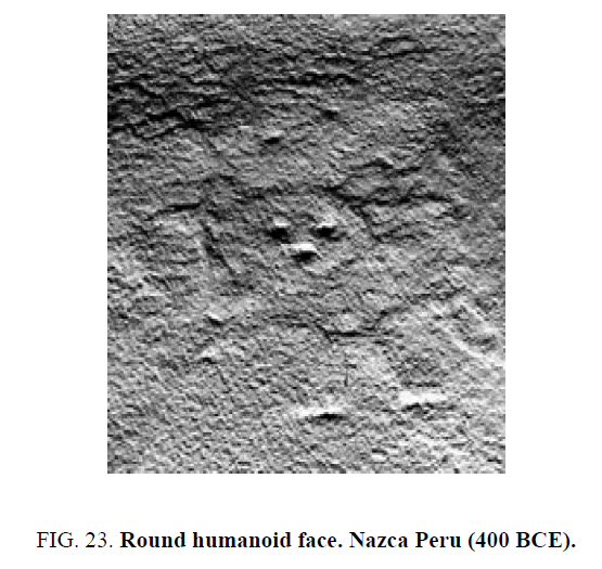
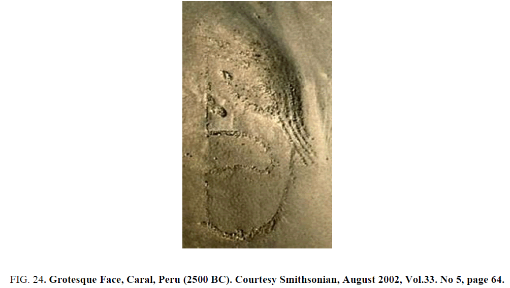
The majority of comparative examples of manipulated terrestrial geology come to us in the form of earthworks that were created by ancient cultures throughout North and South America. Many of these huge mounds and earthworks were shaped like animals and human figures, while others took the form of geometric symbols. It is estimated that the number of earthworks found throughout North America number in the hundreds of thousands. However, over time almost all of these monuments have been either destroyed by natural erosion or by the rapid expansion of rural and urban development. Due to the fact that there are a limited number of examples of facial portraits in the available database, only two meet the criteria of this study with comparable detail and content.
One of the earliest examples of a surviving of a humanoid face is etched in the surface of the Nazca plains of Peru (Figure. 23). Note its basic simplicity, which consists of two round mounds forming eyes, a rectangular nose shape, and an oval impression forming a mouth. The circular head measures about 9 m by 8.5 m. The formation has an arrangement of radial lines around the left and right sides [36].
A second example is a simple rendering of an immense human head located just beyond an ancient complex of mound sand half-buried pyramids found within the ruins of Caral, Peru (Figure. 24). Discovered in early 2000, the site has been dated to well before 2600 BCE [37]. Produced by precisely placing stones across the surface, a D-shaped head is created with a sweeping mat of raked hair and a large gaping mouth. The forehead appears incomplete and there is no evidence of an ear or neck line. Its facial features include a large nose and a small undefined football-shaped eye.
Figure 24: Grotesque Face, Caral, Peru (2500 BC). Courtesy Smithsonian, August 2002, Vol.33. No 5, page 64.
Contemporary geoglyphs
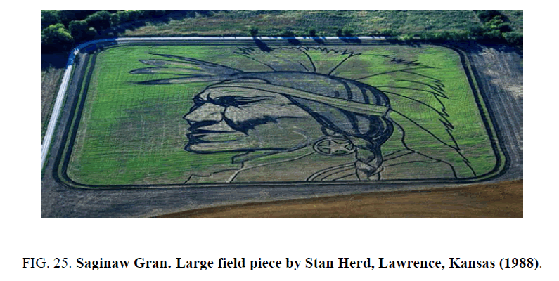
On a large farm, north of Lawrence, Kansas, land artist Stan Herd created what he calls a ''large field piece” depicting a portrait of the American Indian actor, Saginaw Grant in his native regalia (Figure. 25). The right facing portrait features the actor’s stern and weathered face wearing a large star earring and a feathered bandana supporting a long twisted bread of hair. He has a firm chin and pressed lips that are shadowed below a strong and pronounced nose and check bones. His brow is thick and wrinkled from years of squinting at the blazing light of the rising of the sun, which creates a deep and shadowed orbital cavity masking any evidence of an eye feature. The earthwork, which is about 1,000 feet from top to bottom, was created on thirty-acres of wheat stubble in 1988. The artist used a mower and a two-bladed plow to create the dark contours of the portrait. Herd explains that ''I mowed some areas, for another color, and I used a disc, a tool farmers use to turn stubble on its side. Each implement turns the ground another way, and I used them like different pencils [38].
Remote Sensing and Recognizing False Faces
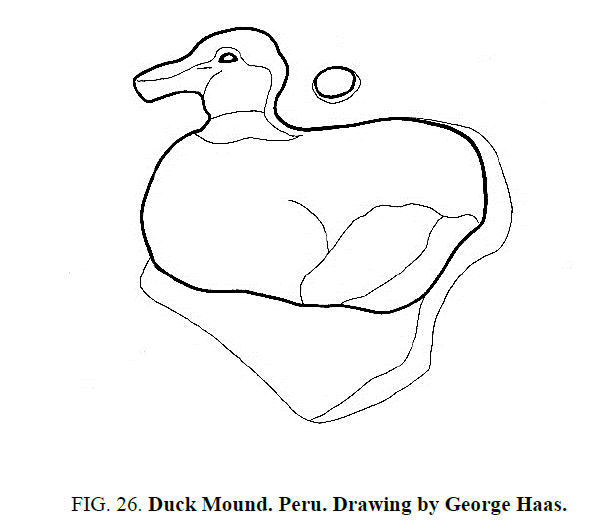
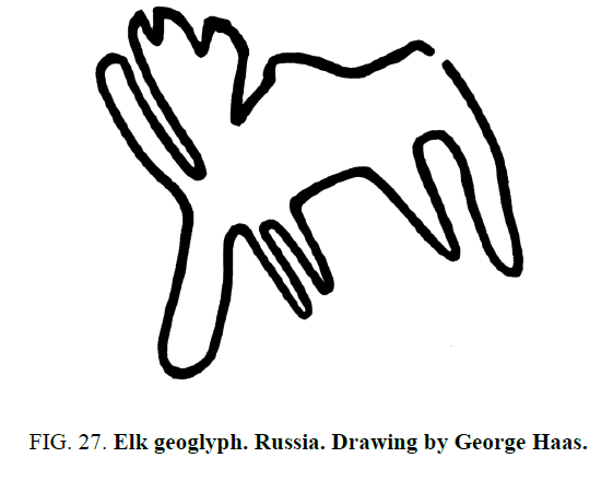
Archaeologist have utilized the application of remote sensing with aerial photography since the 1930’s [39]. This simple technology has been such a crucial tool in the gathering and understanding of archaeological sites and their remains that by the early 1990’s it expanded to include orbiting satellites. Along with archaeologists, scientists at the Jet Propulsion Laboratory in Pasadena, Calif discovered ancient caravan tracks hidden beneath the desert sand that led to a water well known as Ash Shisar, utilizing satellite imagery [40]. In 2010 an anthropologist at the University of Missouri, Robert Benfer, discovered a large duck geoglyph (Figure. 26)near the Chillon Valley in Peru, while studying satellite images on Google Earth [41]. Benfer believes the duck formation to be over 3,000 years old and suggests that it was possibly a natural mound that was altered to form a duck-shape. A year later an elk geoglyph was discovered in the Ural Mountains of Russia that is also estimated to be over 3,000 years old (Figure. 27). The linear formation measuring 218 m long by 275 m wide was discovered by regional specialist Alexander Stanislav after studying aerial photos accessed on the Internet [42]. In an area spanning between Syria by a satellite and aerial photography program based in Jordan. Constructed from stones, the geoglyphs have a wide variety of designs, which include large wheel-like formations measuring 25 m to 70 m across. Archaeologists estimate the formations may have been produced at least 2,000 years ago [43]. During the same year, a team led by an archaeologist and professor at the University of Alabama, Sarah Parcak, released the results of their 11-year remote sensing project of Egypt and stunned the world. With the aid of high-resolution satellite imagery provided by both NASA and Quick Bird satellites the team discovered 17 lost pyramids and nearly 3000 ancient settlements and 1000 tombs [44]. As recently as 2014 over 50 geoglyphs were discovered across northern Kazakhstan in Central Asia by utilizing Google Earth. The geoglyphs are designed in a variety of geometric shapes, including squares, rings, crosses and swastikas that range from 295 to 1,312 feet in diameter. The massive collection of geoglyphs was examined by an archaeological team from Kazakhstan's Kostanay University that used ground-penetrating radar surveys and aerial photography to further study the formations. The results of their study were presented at the European association of archaeologists' annual meeting in Istanbul [45].
It has become clear that with the advent of Google Earth and satellite imagery unknown Geoglyphic formations are being found all over the world. In support of this new research professor Parcak contends that although computer programs have been developed for scanning the world for site detection, the setechnologies cannot replace the power of the human eye. She maintains:
“Computers simply do not have the same ability as human eyes have to pick out subtleties in remotely sensed images. Only the viewer will know what he or she is looking for, based on their background and understanding of the archaeological situation. One cannot input the thousands of minor variables into computers that influence archaeologists when making choices about archaeological data. How will a computer be able to assess similar broad issues for ground surveying? As archaeologists, we can make choices regarding what information we want displayed on satellite imagery, and how we use that information to plan survey seasons. Computers cannot tell if a site or feature is present or not; they just facilitate the display of pixels. It is up to us to determine what those pixels mean [46].
The observation of face-like formations on the surface of Mars are quickly dismissed by mainstream science as the human eye’s tendencies to see facial patterns and is thought to be the effects of pareidolia or some other type of illusion-based condition. The origin of the word “pareidolia” finds its roots with a mental illness that is hunted with hallucinations not anthropomorphic projections [47]. The word was in used in the early 1990’s by a UFO debunker named Steven Goldstin in an article in Skeptical Inquirer magazine [48]. He used the word to reduce any visual acknowledgement of the Face on Mars as a hallucination. From that point on-the word became politicized and quickly adopted by skeptics to discredit any facial for figurative pattern observed on Mars. The charge of pareidolia is now used to convince the public that the human eye not only seeks patterns, but it also has the ability to see false faces everywhere.
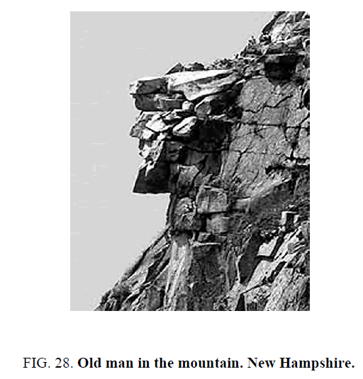
False faces are usually viewed from the ground with the sky as a backdrop and rarely point skyward. They normally require unique lighting conditions and a particular viewing perspective to be fully recognized. The old man of the mountain located in New Hampshire is a common example used to show how false faces are created within the natural landscape (Figure. 28).
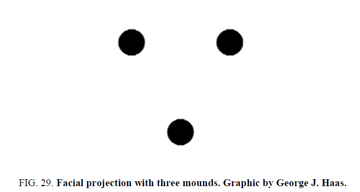
Like the old man in the mountain most of these natural facial formations are crude or grotesque and generally consists of a silhouette with very little facial detail. At best, they are generic, with only the slightest hint of an eye, nose and mouth and rarely include a chin or forehead. They never contain secondary features, such as an iris, defined lips, nostrils, cheeks, hair or even ears. Despite the lack of an official standard for designating a facial formation artificial, it can be agreed that the pattern seeking mind needs only the barest of features. It needs only a triangular grouping of mounds set within a landscape to project the visual illusion of a face with two eyes and a nose (Figure. 29) [49].
It is true that we are a pattern seeking species. We can see hints of facial formations in woodgrain, ink blots and potato chips. If we look to the sky, sometimes we see cloud formations that resemble animals and faces. However, we are able to distinguish between common cloud formations such as Cirrus, Cumulus and Nimbus clouds as opposed to the creation of sky writing and linear streams of contrails expelled from air planes. We understand that clouds are natural and sky writing and contrails are artificial. Therefore, we should be able to have the same discerning eye when looking at formations on Mars. The main difference however is, unlike the ephemeral quality of clouds and contrails, the surface features observed on Mars are durable and are supported by ancillary data [49].
For the human eye to be able to recognize an object within a visual plane we have to understand the process of “image formation” and “image fusion”. Our perception of any given image is formed by our eye’s desire to organize its visual field in an effort to form a complete image. The eye perceives the visual field as a whole as opposed to individual data bits of isolated elements. In a black-and-white image, the eye searches for the visual characteristics, which are darker or lighter in contrast. The eye identifies similar shapes that are grouped closer to those in the perceived viewing field, such as black shapes found within white areas giving form and shape to the image. This type of image completion which separates contrasting groups is called “relative density [50].
Before the human eye is able to fuse the pixels within a black and white image on a computer screen or the halftone dots on a newspaper into a cohesive image, it needs the graduated values of black, white and gray. As the eye recognizes these basic tonalities, it also realizes on the principles of depth perception. An image that may be seen quite clearly from 12 feet away will become indistinguishable if it is enlarged several times and then viewed too closely. The image’s integrity would become corrupted and abstracted and the viewer would be unable to perceive its original content. This would result in the image being reduced to an indecipherable field of geometric patterns [50].
Imagine taking a black and white photograph of Leonardo da Vinci’s Mona Lisa. If your camera zooms in too close, in an effort to capture her famous smile, her lips will be reduced to a splash of undefined brush work. However, if you adjust the focus and image fusion to the proper viewing distance her lips will take form and you will once again see a mouth with slightly parted lips. To produce the proper image fusion of any given image, it is important to designate the distance at which the image or structure was intended to be viewed. As observed with aesthetically deigned landforms on Mars, their intended viewing distance remains ambiguous and may vary depending upon the size of the formation and which portion of a formation is being viewed.
Scale is a major variant when trying to form a cohesive image. Assuming the Bearded profile with Avian Headdress is an intentionally designed work of art that is approximately 150 feet wide and 705 feet long, we would have to determine a proper viewing distance. Challenged with a similar task in determining the origin and purpose of artificial structures in satellite imagery, Dr. Tom Van Flandern compiled a hypothesis of why the face on Mars was designed to be seen from above. He theorized that any facial configuration observed on the surface of a planet would have to be constructed to such a scale that it could only be adequately recognized as being an intended work of art when observed above the planet, at the proper optimal viewing distance [51]. With these basic optical parameters in mind one would conclude that the natural viewing station for the face on Mars, which is a mile and a half in length and a mile wide, would be from a spacecraft or from one of its moons.
To establish an acceptable data set to support a hypothesis that any of these anomalous surface features on Mars are artificial constructs to be viewed from above, we need to develop a testable standard of evidence. Levasseur, a physicist and member of the society for planetary SETI research reminds us that when unusual and unexplained formation is observed, the casual mechanisms are worked out after the anomaly is first observed. He proclaims that “All scientific evidence is based on observations of some kind and it is only after we observe and study the available evidence, that we can then develop a causal mechanism. It is not our burden to establish a viable and believable origin scenario to justify the existence of these formations, because that would be like putting the cart before the horse. In that scenario, you nip science in the bud. We must investigate these formations through observation of the available data set and if multiple images support artificial origins-it is only then that we would be able to speculate on how they got there [52].
Carl Sagan popularized a standard for accepting the discovery of artificial structures on another planet such as Mars, by stating extraordinary claims require extraordinary proof [53]. Hence forth, this has become the high bar provided by skeptics for their acceptance of any Martian anomaly. It assumes that every scientific discovery throughout history was held to the same extreme standards of proof, before being accepted. This surely isn’t true. One needs only to look to the many unexplained archaeological sites and geoglyphs found right here on earth to find fault in this extreme stand. Archaeological sites such as the great pyramids at Gaza and the ruins of Pumapunku Peru are perfect examples. They are two sites that have been intently studied for decades and their construction and origins are still debated [54]. Add to this, the list of geoglyphs present here that were recently found and currently being studied. Even though we don’t fully understand how or why these formations were constructed, we know they exist and someone built them. Perhaps the bearded profile with avian headdress on Mars can be given the same opportunity for scientific review.
Conclusion and Recommendations
The individual facial features that produce the bearded portrait with avian headdress within the Utopia Planita region of Mars are persistent in four images taken by two different NASA spacecraft at three different times and seasons over a four-year period. The surface features are accurately depicted in Mars Odyssey THEMIS image V13127006 and again in MRO HiRISE CTX images P02_001858_2195_XI_39N243W and P15_006961_2213_XN_41N244W and remain clearly visible in MRO HiRISE image PSP_001858_2195.This diverse collection of images shows the formation to be consistent and maintain structural integrity. The synthetic impression of the facial features and avian headdress remains exceptional in regards to its tonality, plasticity and anatomical appearance. The continuity of cultural references is eloquently expressed within the iconographic motifs of art work produced in North American and Middle Eastern cultures and in the land art produced by Stan Herd where a common aesthetic design is strongly supported.
The facial features observed in this bearded portrait with avian headdress are well proportioned and highly detailed despite the actions of natural depositional and erosional agents. While there are known geological mechanisms that are capable of creating and destroying the individual facial features presented in this formation, the natural creation of aesthetically designed formations within the limited boundaries of anatomical correctness seems to go well beyond the probability of chance. Considering the historic study of potentially artificial structures on Mars, such as the Face found in Cydonia, the crowned face of Libya Montes, the profiled face noticed in Syria Planum and the Avian formation discovered in Argyre Basin, it is becoming clear that there is growing evidence to support the artificial origins hypothesis [55].
Therefore, we conclude that the surface features that produce the unique facial components of this bearded portrait with avian headdress in Icaria Planum are real and exhibit a level of consistency that is highly suspect of having artificial origins. We recommend that both NASA and the imaging team at the University of Arizona direct the current MRO spacecraft acquire addition images of these anomalous surface features. New satellite images should be acquired at different times of day and under various sun angles for further analysis. If these features are found to be consistent, we would encourage the pursuit of a ground survey of this area by future rover missions and recommend this site as a prime candidate for the study of potential archaeological artifacts on the surface of Mars.
Acknowledgments
The authors are grateful to Bob Trinket for bringing this formation to our attention in 2006. We also acknowledge Dr. Mark Carlotto and Dr. Brandenburg for their comments and suggestions in regards to reviewing earlier drafts and Levasseur for his help and insights in writing this paper. We extend a special thanks to NASA and the University of Arizona for the use of Mars Odyssey and MRO images that are available on their public web sites. And lastly, we are indebted to Zenith Haas for the editing and formatting of this paper.
References
- Viking 1 and 2. NASA Mars Exploration.Program & Missions. 1975.
- Hoagland RC. The Monuments of Mars: A city on the edge of forever. Berkley: Frog, Ltd, California; 1996.
- Haas GJ, Saunders WR. Cydonia Codex: Reflections from Mars. Berkeley: Frog Ltd, Random House North Atlantic Books, USA; 1997.
- Flandern TV. Proof that the Cydonia Face on Mars is Artificial. Meta Research Bulletin. 2000.
- Carlotto M. Symmetry and Geometry of the Face on Mars Revealed.New Frontiers in Science. 2001;1(1).
- MOC Narrow-Angle image M02-03051 [internet]. Maline space science systems [updated 2000 May 2000; cited on 2016 November 16]. Available from: http://www.msss.com/moc_gallery/ab1_m04/images/M0203051
- Saunders WR, Haas GJ, Miller JS, et al. A Composite Band of Facial Features within a Winding Valley of Libya Montes on thePlanet Mars. J Space Explor. 2015;4(2):147-58.
- http://marsartifacts.tripod.com/.
- Levasseur JP, Haas GJ, Saunders WR, et al. Analysis of the MGS and MRO images of the Syria Planum Profile Face on planet Mars. J Space Explor. 2014;3(3).
- Mars Orbiter Camera [internet]. ASU school of earth and space exploration,MOC: S1301480 [updated on 2016; cited on 2016 November 16]. Available from: http://viewer.mars.asu.edu/planetview/inst/moc/S1301480#P=S1301480&T=2
- Saunders WR, Haas GJ, Miller JS, et al. Avian Formation on a South-Facing Slope Along the Northwest Rim of the Argyre Basin. J Sci Explor. 2011;25(3):515-38.
- Index of /ctx/PSP/ORB_001800_001899/ [internet]. High Resolution Imaging Science Experiment [cited on 2016 November 16]. Available from: http://www.uahirise.org/PSP_001858_2195.
- Haas GJ, Saunders WR. The Martian Codex, More Reflections from Mars. Berkeley: North Atlantic Books; California: 2009;p189.
- DeRosa N. Faces from the Chasmas. Meta Research. 2007:15.
- THEMIS and the Mars Odyssey mission [internet]. ASU school of earth and science exploration [cited on 2016 November 16]. Available from: http://themis.asu.edu/about
- Christensen P. Personal communication with the Principal Investigator for the 2001 Mars Odyssey Thermal Emission Imaging System (THEMIS) instrument. 2008.
- THEMIS: V13127006 [internet]. ASU school earth and science exploration [cited on 2016 November 16]. Available from: https://viewer.mars.asu.edu//planetview/inst/themis/V13127006#P=V13127006&T=2
- Mars reconnaissance orbiter (MRO) context camera (CTX) [internet]. Maline space science systems [cited on 2016 november 16]. Available from: http://www.msss.com/all_projects/mro-ctx.php
- MROcontext camera [internet]. ASU school of earth and science exploration [cited on 2016 November 16]. Available from: viewer.mars.asu.edu/planetview/inst/ctx/P02_001858_2195_XI_39N243W#P=P02_001858_2195_XI_39N243W&T=2
- http://hirise.lpl.arizona.edu/PSP_001858_2195.
- MRO Context CameraCTX: P15_006961_2213_XN_41N244W [internet]. ASU School of earth and science exploration [cited on 2016 November 16]. Available from: http://viewer.mars.asu.edu/planetview/inst/ctx/P15_006961_2213_XN_41N244W#P=P15_006961_2213_XN_41N244W&T=2
- Utopia Planitia [internet]. Gazetteer of Planetary Nomenclature [cited on 2016 November 16]. Available from: http://planetarynames.wr.usgs.gov/Feature/6260?__fsk=-256558109
- McGill GE. Buried topography of Utopia, Mars: Persistence of a giant impact depression. J Geophys Res. 1989;94:2753-9.
- Kerrigan MC, Osinski GR, Van De Wiel M. The Periglacial Landscape of Utopia Planitia; Geologic Evidence for Recent Climate Change on Mars. Dept. of Earth Science, Western University, London, on, Canada 44th Lunar and Planetary Science Conference; 2013.
- Hartmann Wk. A Traveler?s Guide to Mars, The Mysterious Landscapes of the Red Planet. New York: Workman Publishing; USA; 2003;p208.
- Sejourne A, Costard F, Gargani J, et al. Evidence of an eolian ice-rich and stratified permafrost in Utopia Planitia, Mars. Planet Space Sci. 2012;60:248-54.
- Tanaka KL, Skinner JA, Dohm JJM, et al. Geologic Map of Mars. Prepared for the National Aeronautics and Space Administration. 2014:25.
- Patterson A. A Field Guide to Rock Art Symbols of the Greater Southwest. Boulder: Johnson Books; Colorado:1992;p49.
- Schele L, Freidel D. A Forest of Kings: The untold story of the ancient Maya. New York: Quill; USA; 1990;p410.
- Kerr B, Kerr J, The Way of God L: The Princeton Vase Revisited. Record of the Princeton Art Museum. 2005;64:71-9.
- Susan M. Star Gods of the Maya Astronomy in Art, Folklore, and Calendars. Austin: University of Texas Press; US; 1999;p213.
- Edward SC, Graybill FC, Boesen V. Edward Sheriff Curtis: visions of a vanishing race. Albuquerque: University of New Mexico Press; 2000.
- Coins of Khwarezm 2 [internet]. Coins of Central Asia [cited on 2016 November 16]. Available from: http://www.sogdcoins.narod.ru/english/khwarezm/coins2.html
- Levasseur JP, Haas GJ, Saunders WR, et al. Analysis of the MGS and MRO images of the Syria Planum Profile Face on planet Mars. J Space Explor. 2014;3(3):221.
- Solis R, Haas J, Creamer W. Dating Caral a Pre-Ceramic Site in Supe Valley on the Central Coast of Peru. Science. 200;292(5517):723-6.
- Weber B. Works in Progress; Native Ground. The New York Times; 1988.
- Persepolis and Ancient Iran [internet]. The Oriental Institute of the University of Chicago [cited on 2016 November 16]. Available from:https://oi.uchicago.edu/collections/photographic-archives/persepolis/aerial-survey-flights
- Wilford JN. The Frankincense Route Emerges from the Desert. The New York Times; 1992.
- Wall T. Rare Animal-Shaped Mounds Discovered in Peru by MU Anthropologist.News Bureau University of Missouri: Columbia; 2012.
- Grigoriev SA, Menshenin NM. Discovery of a geoglyph on the Zjuratkul Ridge in the southern Urals. Antiquity. 2012;86(331).
- Jarus O. Visible Only from Above, Mystifying 'Nazca Lines' Discovered in Mideast. NBC NEWS.com Science. 2011 Sept 15.
- Pringle H. Satellite ImageryUncovers Up to 17 LostEgyptianPyramids. Science. 2011.
- Nazca lines of Kazakhstan: More than 50 geoglyphsdiscovered. Fox News Science. 2014 Sept 24.
- Parcak S. Satellite RemoteSensing for Archaeology. New York:published by Routledge; 2009.
- Mamiya Y, Nishio Y, Watanabe H, et al. The pareidoliatest:A simple neuropsychological test measuringvisual hallucination-like illusions. Plos One. 2016;11(5):e0154713.
- Goldstin S."Watch WhatYou'reThinking! The Skeptic'sToolbox II Conference".SkepticalInquirer Magazine. 1994;18(4):1-13.
- Levasseur JP, Haas GJ, Saunders WR et al. Analysis of the MGS and MRO images of the Syria Planum Profile Face on planet Mars. J SpaceExplor. 2014;3(3):223.
- Anderson DM. Elements of Design. New York: Holt, Rinehart and Winston.961;p36.
- Flandern TV. PreliminaryAnalysis of April 5 Cydonia Image from the Mars Global SurveyorSpacecraf. Meta Research. 1999.
- Levasseur JP. Personal conversation. 2015.
- Carl S. EncyclopaediaGalactica. Cosmos Episode 12.1980.
- Levasseur JP, Haas GJ, Saunders WR et al. Analysis of the MGS and MRO images of the Syria Planum Profile Face on planet Mars. J SpaceExplor. 2014;3(3):225.
